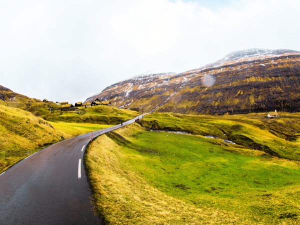
The Faroe Islands combine glacial scenery with fast-changing light, which gives landscape photographers very different conditions within one day. During the Faroe Islands golden hour, low light can turn green slopes gold and break through clouds in narrow beams. Storms and fog can interrupt your plans, but clearing weather often creates the strongest skies.
Renting a car in Faroes gives you control over your start times, stops, and route changes. The main road network links Vágar with Streymoy, Eysturoy, and Sandoy through bridges and subsea tunnels.
The Faroe Islands photography spots below are all reachable by road from Vágar Airport without taking a ferry. Our guide shows you how to plan your drives, choose practical island clusters, and move between sunrise and sunset locations.
Before choosing sunrise and sunset stops, check tunnel access, driving times, and weather conditions. These details affect how far you can realistically travel in one day.
Vágar Airport is around 45 minutes by car from Tórshavn in normal conditions. The 4.9-kilometre Vágatunnilin links Vágar with Streymoy, where roads continue towards the capital and northern villages. Further connections lead towards Eysturoy and Sandoy, so you can plan a Faroe Islands road trip around several islands.
Plan each day around one island or nearby group instead of crossing the same roads several times. On Vágar, you can combine Sandavágur, Bøur, Gásadalur, and Sørvágsvatn. Northern Streymoy works well for Saksun, Fossá, and Tjørnuvík, while southern Streymoy links Kirkjubøur, Tórshavn, and Norðradalur.
Keeping each loop compact gives you more time at the Faroe Islands photography spots you have chosen. You can scout a composition, wait through a shower, or return to a nearby viewpoint when light improves. Shorter drives also make it easier to change your plan before sunrise or sunset.
Sunrise and sunset times change sharply across the year in the Faroe Islands. Around late June, sunrise is about 3:36 A.M., while sunset is about 11:21 P.M. In early December, sunrise is around 9:20 A.M. and sunset around 3:11 P.M. Times vary slightly by location, so check your travel date before planning each route.
Coastlines face different directions, so the same weather can produce very different light across nearby islands. Keep one backup location within a short drive, especially when low cloud covers a high ridge.
Autumn light can turn wet grass bright gold, while broken cloud may send narrow beams across valleys. Fog can also hide a viewpoint within minutes. If Saksun is covered, Fossá or another lower location may still be clear. Plan nearby alternatives to catch better light without driving too far.
The routes below cover some of the best photo spots in the Faroe Islands that you can reach from Vágar Airport.

Start near Sandavágur with Trøllkonufingur, the 313-metre rock pillar east of the village. Use the marked parking area and walk for 20 minutes for the final 1.4 kilometres each way. Morning light can work well here when clouds are high enough to reveal the coast. From the path above the bay, you can frame the pillar against sea and sky.
Continue west to Bøur after sunrise, around 15 minutes away by car. The village offers clear views toward Tindhólmur and the Drangarnir sea arch across the water. Turf-roofed houses, the shoreline, and Tindhólmur's five sharp peaks offer several foreground options. Late morning or afternoon light can bring more detail into the slopes beyond the village.
Finish in Gásadalur for Múlafossur, where the waterfall drops from the cliff into the Atlantic. The classic viewpoint just beyond the village tunnel includes the falls, green ridge, and village above. Viewpoint space is limited, so stay back from the edge. Changing evening weather can bring warm light, low clouds, rainbows, or darker skies to Faroe Islands viewpoints.

Start near Miðvágur for the walk towards Trælanípa and Bøsdalafossur. The viewpoint creates the well-known illusion of Sørvágsvatn appearing high above the Atlantic. Plan around 45 minutes each way for the main walk, with extra time for photographs. The wider route towards Bøsdalafossur can take around 2 hours in total. The trail requires check-in and a hiking fee, so check current access before arriving.
From the same area, you can photograph Bøsdalafossur dropping from the lake into the ocean. After returning to your car, continue to Bøur for Tindhólmur and Drangarnir. Finish at Gásadalur again if evening conditions look better on the western coast. The route combines one of the most famous Faroe Islands photography spots with two easy roadside village stops.

Drive through Vágatunnilin and continue north towards Saksun, roughly 1 hour from Vágar Airport. Saksun is surrounded by steep mountains, with turf-roofed buildings and the tidal lagoon Pollurin below. Soft or broken light can keep more detail on both sides of the valley than strong midday sun.
Continue towards Fossá near Haldórsvík. At 140 metres, Fossá is the highest waterfall in the Faroe Islands and drops in two main stages. Use the roadside parking area, then walk towards the lower viewpoint. Use a slower shutter to soften the waterfall, and watch your footing on wet ground.
Finish at Tjørnuvík, where the dark beach faces Risin og Kellingin across the water. Low evening light can turn the sea stacks into strong silhouettes. The exposed coast also works well when clouds move across the horizon. Give yourself time before sunset because the narrow approach road and passing places can slow your final drive.
For more freedom between sunrise and sunset, you can book a car rental with Final Rentals before your trip. Your booking includes unlimited mileage and winter tyres, plus Collision Damage Waiver, Theft Waiver, and Third Party Liability. Compact cars, SUVs, and premium options are available when you need more room for luggage and camera gear.

Begin in Kirkjubøur at the southern end of Streymoy. You can photograph St. Magnus Cathedral, St. Olav's Church, turf-roofed buildings, and views towards Hestur, Koltur, and Sandoy. The church and cathedral ruins are among the island group's most important historic buildings. Early light can bring texture to the old stone walls before you continue north.
Drive to Tórshavn in late morning and walk through Tinganes and the harbour area. Red timber buildings, grass roofs, boats, lanes, and the Vågsbotn waterfront give you a different subject from the open landscapes. Cloudy midday weather can work well here because softer light reduces harsh contrast on buildings and narrow streets. Several Faroe Islands photography spots here are close enough to cover on foot.
Head west towards Norðradalur during the afternoon. Stop around Norðradalsskarð for a high view over the winding road, U-shaped valley, and Koltur beyond. Continue lower for wider views framed by Núgvan, Stiðjafjall, and Tungulíðfjall. Western evening light can reach the slopes and ocean, giving you a strong final stop without a long hike.
Drive from Streymoy into Eysturoy and head north towards Eiði. The village has coastal views on both sides of its narrow setting, including a small bay and open water. From here, continue towards Funningur beneath the high mountains of northern Eysturoy.
Funningur is at the end of Funningsfjørður, with a turf-roofed church and steep slopes behind the village. Nearby Hvíthamar gives you a higher view down the fjord towards Funningur. The walk is around 1.5 kilometres return and usually takes about 1 hour. The ridge is exposed to wind, so keep away from steep edges in poor visibility. Broken evening cloud can also send narrow light beams across the fjord, which makes Hvíthamar especially useful near sunset.
Finish at Gjógv, where the natural gorge cuts around 200 metres into the basalt coast. Nearby Faroe Islands photography spots include village details and wider coastal scenes. The coastal road also has several open sea views before you reach the village.
You can photograph the inlet, white church, village roofs, and nearby cliffs. Evening side light may reach the village and distant Kalsoy when skies stay open. Watch for sheep on the mountain roads between these stops, especially around bends.
For a higher route, start at Eiði and follow the road towards Slættaratindur. At 882 metres, it is the highest mountain in the Faroe Islands. Roadside stopping areas along the pass give you broad mountain and island views without needing to climb the summit.
Continue towards Gjógv as the afternoon light lowers. The sea-filled gorge is the main subject, but the church and layered basalt cliffs give you several other compositions. On clear evenings, angled light can catch rooftops and the distant coastline. The drive itself also gives you wide highland views, so use only safe parking areas before taking photographs.

Drive through Streymoy and enter Sandoy through Sandoyartunnilin. Sandur is around 1 hour and 30 minutes from Vágar Airport by car. Start at the beach and protected dunes. Black basalt sand, marram grass, and open shoreline create softer foregrounds than many northern islands.
Continue to Húsavík for turf-roofed houses and village details among green slopes. Roads inside the village are narrow, so use the main parking area and explore on foot. From Húsavík, the Dalstunnilin now gives you a direct road connection to Dalur. The 2.2-kilometre tunnel replaced the older exposed coastal approach.
Finish at Dalur, the southernmost village on Sandoy. Steep mountains rise around the settlement and small bay, giving you strong shapes as evening light drops. Calm water can reflect sections of sky and hillside, which works well for longer exposures. Sandoy is useful when you want photo locations with a different landscape from Vágar or northern Streymoy.
Driving conditions can affect how many locations you can realistically photograph in one day. Here are things to know before driving in the Faroe Islands to stay safe.
Expect narrow roads on smaller islands, mountain routes, and approaches to villages. Roads towards Saksun and Norðradalur are good examples, with passing places used when traffic meets. Some older tunnels also have one lane with passing places. Use the marked passing bays correctly and wait when another driver has priority.
Roads towards places such as Saksun can take longer than the distance suggests. Headlights should stay on while driving, including inside tunnels. If visibility drops sharply in fog, move to a safe parking area or choose a lower location.
Use marked parking areas wherever possible, especially near popular viewpoints and villages. Gjógv has public parking, while Trælanípa has parking near the trail entrance. Gásadalur also has places where you can park before walking towards Múlafossur.
Never block a farm entrance, home, narrow road, or passing bay while exploring Faroe Islands photography spots. Walk the final section when a safe car park is available. Keeping roads clear is important in villages, where local traffic, buses, farm work, and visitors often share limited space.
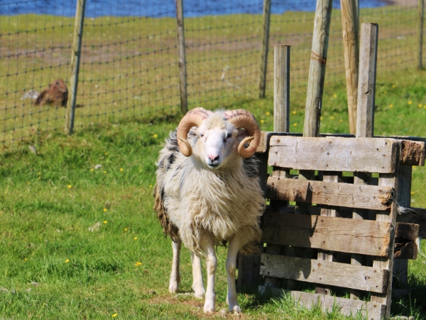
Sheep are common on rural roads and can move onto the carriageway without warning. Reduce your speed near animals and around bends where you cannot see far ahead. Give sheep time to move rather than sounding your horn or driving closely behind them.
Subsea tunnels are toll roads, while some older mountain tunnels are single-lane. Rental-car tunnel charges are handled through the car rental company, so check its payment process before your first crossing.
The best Faroe Islands photography spots are spread across different coasts, valleys, and elevations. Weather may block one location while another remains clear. Choosing stops within the same area makes those changes easier to manage. You can then adjust your route without losing the sunrise or sunset window to a long drive.
Rent a car in the Faroe Islands with Final Rentals to start early and return after the last light. You can arrange unlimited use of the Vágar and Norðoyar tunnels when booking. Book and manage your car rental anytime. Download the Final Rentals app on Google Play and the App Store.
Yes. Vágar connects with Streymoy through Vágatunnilin, and road links continue towards Eysturoy and Sandoy. Driving time still varies with weather, narrow roads, tunnels, and photo stops. Plan one regional route each day instead of crossing several islands repeatedly between sunrise and sunset.
No, an SUV is not required for normal driving. A compact car can be easier on narrow village roads and in small parking areas. An SUV may give you more luggage room for tripods, waterproof clothing, and camera bags. Choose a car type based on your head count, gear, and confidence on narrow roads.
Check the forecast, cloud level, sunrise direction, and sunset direction before leaving. Keep a second location within a short drive in case fog covers your first choice. Lower valleys and coastal stops may stay clear when higher ridges disappear into cloud. Avoid chasing distant light across several islands. You will usually have more time to photograph when your backup spot is nearby.