Finalrentals Blog

Published in Trips Category.
Gásadalur is a tiny village on the west side of Vágar Island, wedged between steep mountains and the North Atlantic coast. Its most famous feature is the Múlafossur waterfall. You can reach Gásadalur by driving through paved island roads, or on foot via the old postman’s trail from Bøur. The waterfall viewpoint requires only a brief marked walk, and the long mountain hike is a separate route.
If you arrive by plane, you can rent a car at Vágar Airport to access these remote viewpoints and trails. Our guide explains the drive, parking, viewpoint, village, and demanding hike between Bøur and Gásadalur.
How to Reach Gásadalur by Car
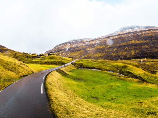
The Gásadalur road trip follows paved island roads towards a narrow coastal section. Fog, rain, side winds, sheep, and tight bends can slow your journey.
Drive From Vágar Airport to Gásadalur
Gásadalur is about 11 kilometres west of Vágar Airport. The drive usually takes 15 to 20 minutes without stops.
Leave the airport on Route 22 towards Sørvágur.
In Sørvágur, join Route 45 towards Bøur and Gásadalur.
Pass Bøur and enter the 1.4-kilometre Gásadalstunnilin.
Leave the tunnel and follow signs into Gásadalur.
You can rent a car at Vagar Airport after your flight and begin the Gásadalur road trip nearby. Across Sørvágsfjørður, you may see Tindhólmur, Gáshólmur, and distant Mykines in clear weather. Stop only in marked pull-ins, never on blind bends or near the tunnel bridge.
Drive Safely on the Coastal Road and Tunnel
The road narrows beyond Sørvágur and passes through Bøur. Gásadalstunnilin is a dark, one-lane mountain tunnel, so use headlights and reduce your speed. Use the passing places when traffic approaches. You may need to reverse towards the nearest space. Never park or walk inside the tunnel. On exposed sections, wait in a safe pull-in if wind or visibility becomes dangerous.
Drive on the right and follow all limits. Locals may flash twice when asking to pass, so let them pass when safe. Rural roads may be narrow or gravelled. You may also need to reverse on very tight sections. Book a car with Final Rentals for your Gásadalur road trip and get winter tyres, collision cover, and theft protection included.
How to Visit Múlafossur Waterfall and Gásadalur

A Gásadalur road trip does not require a long or difficult hike. The main Múlafossur viewpoint is only minutes from the village parking area.
Park Safely in Gásadalur
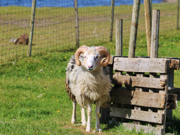
Follow the signs towards the visitor parking area beside the main lane and public toilets. Use marked spaces without blocking roads, gates, farm entrances, homes, or emergency access. Never drive or park on grass, turf, or farmland. Off-road driving is illegal. Gásadalur is a working farming village. Stay outside private yards and watch for sheep around the car park.
Walk to the Múlafossur Waterfall Viewpoint
The marked path takes around 2 to 5 minutes and is mostly flat. Open grassland leads to a fenced viewpoint above Múlafossur. The waterfall drops more than 30 metres into the Atlantic. You can also see the village and Mykines during clear weather.
Wear shoes with a good grip during wet or windy weather. Stay on the path and behind fences because the cliff edge is dangerous. Strong winds can blow spray upwards and buffet exposed areas. Move back or wait if conditions become unsafe.
Explore Gásadalur Village
Walk through the narrow lanes after seeing the waterfall. You will find grass-roofed houses, small farms, and perhaps an open local café. Opening days vary.
Old ruins named Uppi við Garð and Gæsutoftir show parts of the village's medieval past. View them without entering the ruins, fields, or private yards. Árnafjall rises 722 metres above the valley and is Vágar's highest mountain. This quiet village makes for a slower stop on your Gásadalur road trip. Respect residents, grazing animals, and all marked public paths.

How to Go Hiking in Gásadalur
The old postman’s trail is a demanding mountain walk from Gásadalur towards Bøur. It is separate from the short path leading to Múlafossur Waterfall.
Start the Historic Trail From Gásadalur
The trail begins about 75 metres from the Gásadalur tunnel entrance. You can park near the public toilets in the village. Another small parking area is below the tunnel, opposite the sheepfold.
Villagers once used this old path for church, trade, errands, and journeys to Bøur cemetery. The route covers about three kilometres each way. A one-way hike takes around one hour and five minutes in good weather. The trail reaches 434 metres, with around 304 metres of climbing. Starting from Gásadalur means facing the steepest section first.
Follow the Mountain Path Towards Bøur
The path climbs sharply from Gásadalur towards Skarði Pass. Loose stones make the first section difficult, especially after rain. Take small steps and keep away from exposed cliff edges. From higher ground, you can see Sørvágsfjørður, Tindhólmur, Gáshólmur, and Mykines. Several historic and folklore sites appear along the route.
Skarði Pass marks the highest part of the climb from Gásadalur.
Risasporið resembles a giant’s footprint linked to local folklore.
Vígdá Spring is connected to a story about a baby baptised during a journey to Bøur.
Líksteinurin is where coffin bearers once stopped to rest.
The path later crosses Gásadalsbrekkan before descending towards Bøur. Mud and wet grass can make this section slippery. Turn back if there’s too much fog, rain, or strong winds.
Plan Your Return and Hiking Safety
The trail is a point-to-point route, so plan your return before leaving. With a car, walk part of the trail and return to Gásadalur. Completing the full return route doubles the distance and climbing. Pack waterproof clothing, warm layers, sturdy boots, water, snacks, and a first-aid kit. Bring a charged phone and an offline map or GPS. Tell someone where you are going before starting.
Children need close supervision on this route. It may suit experienced children aged 10 or older. Smaller children should use the short Múlafossur viewpoint path instead. Experienced hikers can continue towards the abandoned village of Víkar. That route covers around 10 kilometres and takes about 4 hours. It crosses difficult mountain land and is unsuitable for casual visitors.
Takeaway
A Gásadalur road trip can be as easy or active as you choose. Múlafossur is only a short walk from the village parking area. You can explore the village or follow part of the old postman’s trail towards Bøur. Choose the option that suits your time, fitness, and the weather.
Rent a car in the Faroe Islands with Final Rentals to enjoy unlimited mileage between remote villages and viewpoints. You also receive free 24/7 breakdown assistance, with a replacement car available within 24 hours for vehicle faults. Book and manage your car rental at any time. Download the Final Rentals app on Google Play and the App Store.
Frequently Asked Questions
How long is the drive from Vágar Airport to Gásadalur?
It’s about 11 kilometres (7 miles), which takes roughly 17 minutes without stops. From the airport, follow Route 22 to Sørvágur, then Route 45 west through Bøur and the Gasadalur Tunnel.
Do I have to hike to see the Múlafossur waterfall?
No. The main Múlafossur viewpoint is reached by a very short marked walk about 2 to 5 minutes from the village parking lot. No long hike is needed to view the waterfall. The challenging mountain trail to/from Bøur is a separate, optional hike.
Is hiking in Gásadalur difficult?
The mountain path over Gásadalsbrekkan is steep and rated as difficult. The descent is very steep and slippery in places. It requires good boots and fitness. In contrast, casual visitors can still enjoy the waterfall safely via the short, flat trail from the car park.